Historic Route 66 Highway

Our restaurant, the Red River Steakhouse, is situated on the famous Route 66 highway immortalized by the popular song recorded in the 1960s, that runs through both Amarillo and McLean, Texas. We serve prime Certified Hereford Beef obtained from a rancher 60 miles north of Amarillo, Texas. Located in the Panhandle of Texas, both Red River Steakhouse restaurants have been a welcome sight to tens of thousands of hungry travellers motoring down this historic highway that runs through both McLean and Amarillo, Texas.
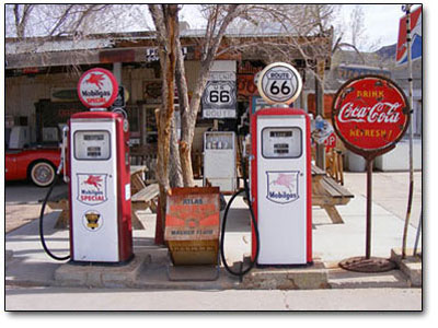
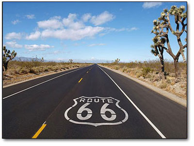
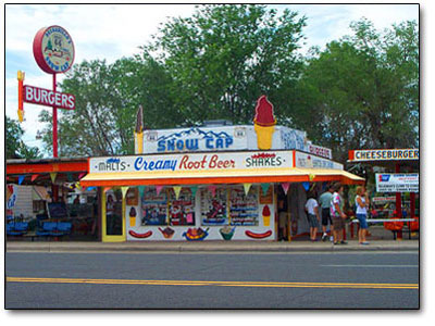
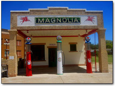
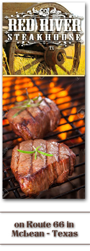
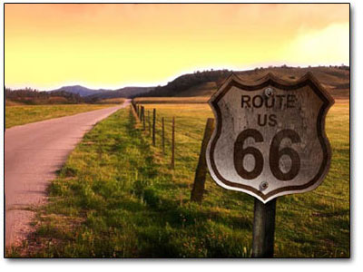
The highway known as U.S. Route 66 has also been known as the Will Rogers Highway and the Mother Road. This famous highway is just a stones throw from the front door of the Red River Steakhouse, in McLean, Texas. One of the original U.S. Highways, Route 66 was established on November 11, 1926 with road signs erected the following year. The highway, which became one of the most famous roads in America and eventually worldwide, ran originally from Chicago through the states of Missouri, Kansas, Oklahoma, Texas, New Mexico, Arizona, and California, before ending in Los Angeles after covering a total of 2,448 miles or 3,940 kilometers.

It gained acclaim in popular culture by both the hit song and the Route 66 television show in the 1960s which portrayed the travels of two young men travelling Route 66 in a convertible Corvette starring Martin Milner as Tod Stiles and initially George Maharis as Buz Murdock. Route 66 served as a major road for those heading west, especially during the Dust Bowl of the 1930s, and it supported the economies of the communities through which the road passed. Individuals doing business along the route became prosperous due to the growing use and popularity of the highway, with these same people later fighting to keep the highway alive in the face of the growing threat posed by being bypassed by the new Interstate Highway System. But, it was officially removed from the United States Highway System on June 27, 1985 after it had been replaced in its entirety by the new Interstate Highway System.

Portions of this road that passed through Illinois, Missouri, New Mexico, and Arizona have been designated a National Scenic Byway with the name of Historic Route 66. The birth of Route 66 began when in 1857, Lt. Edward Fitzgerald Beale, a Naval officer in the U.S. Army Corps of Topographical Engineers, was ordered by the War Department to build a government funded wagon road along the 35th Parallel. His secondary orders were to test the feasibility of the use of camels as pack animals in the desert of the southwestern United States and this road became part of U.S. Route 66.
Before a nationwide network of highways with numbered designations was adopted by the states, these roads were marked by private organizations. The route that would become Route 66 was covered by three highways. The Lone Star Route passed through St. Louis on its way from Chicago to Cameron, Louisiana, though U.S. 66 would take a shorter route through Bloomington rather than Peoria. The transcontinental National Old Trails Road led via St. Louis to Los Angeles, but was not followed until New Mexico; instead U.S. 66 used one of the main routes of the Ozark Trails system, which ended at the National Old Trails Road just south of Las Vegas, New Mexico. Again, a shorter route was taken, here following the Postal Highway between Oklahoma City and Amarillo, Texas. Finally, the National Old Trails Road became the rest of the route to Los Angeles.
While legislation for public highways first appeared in 1916, with revisions being made in 1921, it was not until Congress enacted an even more comprehensive version of the act in 1925 that the government executed its plan for national highway construction. Officially, the numerical designation 66 was assigned to the Chicago to Los Angeles route in the summer of 1926. With that designation came its acknowledgment as one of the nation’s principal east–west arteries. Officially recognized as the birthplace of U.S. Route 66, it was in Springfield, Missouri and on April 30, 1926 that officials first proposed the name of the new Chicago to Los Angeles highway.
A placard in Park Central Square was dedicated to the city by the Route 66 Association of Missouri, and traces of the old road are still visible in downtown Springfield along Kearney Street, Glenstone Avenue, College and St. Louis streets and on Missouri 266 to Halltown, Missouri. Championed by Tulsa, Oklahoma businessman Cyrus Avery when the first talks about a national highway system began, U.S. 66 was first signed into existence by a law in 1927 as one of the original U.S. Highways, although it was not completely paved until 1938. Avery was adamant that the highway have a round number and had proposed number 60 to identify it. A controversy erupted over the number 60, largely from delegates from Kentucky which wanted a Virginia Beach to Los Angeles highway to be U.S. 60 and U.S. 62 between Chicago and Springfield, Missouri. Arguments and counter-arguments continued and the final conclusion was to have U.S. 60 run between Virginia Beach, Virginia, and Springfield, Missouri, and the Chicago to Los Angeles route be U.S. 62.
Avery settled on the number 66, which was unassigned, because he thought the double-digit number would be easy to remember as well as pleasant to say and hear. But, the state of Missouri released its 1926 state highway map with the highway labeled as U.S. Route 60. After the new federal highway system was officially created, Cyrus Avery called for the establishment of the U.S. Highway 66 Association to promote the complete paving of the highway from end to end and to promote travel down the highway.
In 1927, in Tulsa, the association was officially established with John T. Woodruff of Springfield, Missouri elected the first president. In 1928, the association made its first attempt at publicity by sponsoring the “Bunion Derby”, a footrace from Los Angeles to New York City, of which the path from Los Angeles to Chicago would be on Route 66. The publicity worked: several dignitaries, including Will Rogers, greeted the runners at certain points on the route. The race ended in Madison Square Garden, where the $25,000 first prize (equal to $338,372 in 2012 dollars) was awarded to Andy Hartley Payne, a native American Cherokee runner from Oklahoma. The U.S. Highway 66 Association also placed its first advertisement in the July 16, 1932, issue of the Saturday Evening Post. The ad invited Americans to take Route 66 to the 1932 Summer Olympics in Los Angeles. A U.S. Highway 66 Association office in Oklahoma received hundreds of requests for information after the ad was published. The association went on to serve as a voice for businesses along the highway until it was disbanded in 1976.
Traffic grew on the highway because of the geographic scenery through which it passed. Much of the highway was essentially flat and this made the highway popular as a truck route. The Dust Bowl of the 1930s saw many farming families, mainly from Oklahoma, Arkansas, Kansas, and Texas, heading west along it for agricultural jobs in California. Route 66 became the main road of travel for these people, often derogatorily referred to as “Okies” or “Arkies”. Also during the Depression, it gave some economic relief to communities located on the highway.
The route passed through numerous small towns, and with the growing traffic on the highway, it helped create the rise of mom-and-pop businesses, such as service stations, restaurants, and motor courts, all readily accessible to passing motorists. Much of the early highway, like all the other early highways, was gravel or graded dirt. Due to the efforts of the U.S. Highway 66 Association, Route 66 became the first highway to be completely paved in 1938. Several places were dangerous: more than one part of the highway was nicknamed “Bloody 66” and gradually work was done to realign these segments to remove dangerous curves. However, one section just outside Oatman, Arizona, through the Black Mountains, was fraught with hairpin turns and was the steepest stretch along the entire route. Many early travelers who were too frightened at the prospect of driving such a potentially dangerous road, hired locals to navigate the winding grade through the Black Mountains. The section remained as Route 66 until 1953, and is still open to traffic today as the Oatman Highway. Despite such hazards in a few areas, Route 66 continued to be a popular route.
Notable buildings include the art deco-styled U-Drop Inn, constructed in 1936 in Shamrock in Wheeler County east of Amarillo, Texas, listed on the National Register of Historic Places. A restored Magnolia fuel station is also located in Shamrock as well as Vega in Oldham County west of Amarillo. During World War II, more migration west occurred because of war-related industries in California. Route 66, already popular and fully paved, became one of the main migration routes and also served for moving military equipment. In the 1950s, Route 66 became the main highway for vacationers heading to Los Angeles.
The road passed through the Painted Desert and near the Grand Canyon, with Meteor Crater in Arizona being another popular stop. This sharp increase in tourism in turn gave rise to a burgeoning trade in all manner of roadside attractions, including teepee-shaped motels, frozen custard stands, Indian curio shops, and reptile farms. The Meramec Caverns near St. Louis began advertising on barns, billing itself as the “Jesse James Hideout”. The Big Texan restaurant in Amarillo advertises a free 72 ounce or 2 kilogram steak dinner to anyone who could consume the entire meal in one hour. The beginning of the end for Route 66 came in 1956 with the signing of the Interstate Highway Act by President Dwight Eisenhower who was influenced by his experiences in 1919 as a young Army officer crossing the country in a truck convoy on Route 66, and his appreciation of the German Autobahn network as a necessary component of a national defense system.
During its nearly 60 year existence, Route 66 was constantly undergoing changes. As highway engineering became more sophisticated, engineers constantly sought more direct routes between cities and towns. Increased traffic led to a number of major and minor realignments of Route 66 through the years, particularly in the years immediately following World War II when Illinois began widening US 66 to four lanes through virtually the entire state from Chicago to the Mississippi River.
By the early to mid 1950s, Missouri also upgraded its sections of Route 66 to four lanes complete with bypasses. Most of the newer four lane Route 66 paving in both states was upgraded to freeway status in later years. In many communities, local groups have painted or stencilled the 66 and U.S. Route shield or outline directly onto the road surface, along with the state’s name. This is common in areas where conventional signage for “Historic Route 66” is a target of repeated theft by souvenir hunters. Various sections of the road itself have been placed on the National Register of Historic Places. The Arroyo Seco Parkway in the Los Angeles Area and Route 66 in New Mexico have been made into National Scenic Byways. In 2005, the State of Missouri made the road a state scenic byway from Illinois to Kansas. In the cities of Rancho Cucamonga, Rialto, and San Bernardino in California, there are US 66 signs erected along Foothill Boulevard, and also on Huntington Drive in the city of Arcadia.
Historic Route 66 signs may be found along the old route in Pasadena on Colorado Boulevard, San Dimas, LaVerne, and Claremont, California along Foothill Boulevard. The city of Glendora, California renamed Alosta Avenue, its section of Route 66, by calling it Route 66. Flagstaff, Arizona renamed all but a few blocks of Sante Fe Avenue as Route 66. The Chicago Blues Festival held each year in June in Grant Park, includes a Route 66 Roadhouse stage which is located on the actual pavement of old US Route 66, on Jackson Boulevard which is closed to traffic for the festival.
Since 2001, Springfield, Illinois has annually held an “International Route 66 Mother Road Festival” in its downtown district surrounding the Old State Capitol. US Route 66 went through Amarillo while covering 180 miles or 290 kilometers of the Texas Panhandle. The leaning water tower, east of Groom, Texas sits along I-40 which is the old U.S. Route 66. Many service stations from the 40’s and 50’s still survive along its path, like one in Allen Reed Texas and Shamrock, Oklahoma, even if they no longer pump gas. Excerpted from Wikipedia
One of the best kept secrets in Texas – The Red River Steakhouse in McLean, Texas. Its a place that embodies the spirit of the wild west, the power of great hunters, and the classic feel of Route 66. When you’re out gettin’ your kicks on Route 66 please do stop in! www.redriversteakhouse.com
0 Shares