In Arizona the first town on Route 66 is Holbrook which is a city in Navajo County, Arizona. Holbrook was founded in 1881 or 1882, when the railroad was built, and named to honor the first chief engineer of the Atlantic and Pacific Railroad. After the appearance of a smoke trail in the sky on July 19th, 1912, a meteorite with an estimated mass of 190 kilograms exploded over the town and a shower of stones fell from the sky, estimated to number more than 16,000 and varying in weight from 6.6 kilograms to less than 0.1 grams.
Historic U.S. Route 66 runs through Holbrook where the Wigwam Motel on Hopi Drive was built in 1950 and is now listed in the National Register of Historic Places. During 1881 and 1882, railroad tracks were laid down and a railroad station was built in the town. Many of the events that played out during the Pleasant Valley War up to 1887 occurred in and around the town of Holbrook. Visitors can witness the natural wonder of the Petrified Forest National Park, located 28 miles or 45 kilometers east of Holbrook. The historic Navajo County Courthouse and Museum in Downtown Holbrook was built in 1898. The courthouse is now home to the Navajo County Historical Society and is listed on the National Register of Historic Places.
Next is Winslow (Navajo: Béésh Sinil or Béésinil), a city in Navajo County, Arizona. The town was named for either Edward F. Winslow, president of St. Louis and San Francisco Rail Road, which owned one half of the old Atlantic and Pacific Railroad, or Tom Winslow, a prospector who lived in the area. No one seems to know which one it was. The last Harvey House named La Posada Hotel opened in 1930. The Fred Harvey Company was the owner of the Harvey House chain of restaurants, hotels, and other hospitality industry businesses alongside railroads in the western United States.

Designed by Mary Colter, the hotel closed in 1957 and was used by the Santa Fe Railroad for offices. The railroad abandoned La Posada in 1994 and announced plans to tear it down. It was saved and now caters to Route 66 fans. U.S. Route 66 was originally routed through the city. When a contract to build I-40 as a bypass north of Winslow was awarded at the end of 1977, I-40 replaced U.S. Route 66 through Arizona in its entirety.

The town of Winslow achieved national fame in 1972 with the Eagles’ song Take it Easy in which the line “standing on a corner in Winslow, Arizona. was included. Winslow is served by Winslow-Lindbergh Regional Airport which was originally constructed by Transcontinental Air Transport. The Winslow airport was designed by Charles Lindbergh, who stayed in Winslow during its construction. This airport was paid for by Howard Hughes and When it was built, it was the only all-weather airport between Albuquerque, New Mexico and Los Angeles, California. There are currently no commercial airlines servicing this airport.

From Winslow travel on to Flagstaff (Navajo: Kinłání Dookʼoʼoosłííd Biyaagi – Havasupai: Wii Hagnbaj), but if you’d like to take a little trip on the side then go see Meteor Crater, 6 miles from south of I-40 at exit 233. It is the best preserved meteorite impact site in the world just minutes from Interstate 40. Meteor Crater is the awesome result of a collision between a piece of an asteroid traveling at 26,000 miles per hour and planet Earth approximately 50,000 years ago. Meteor Crater is nearly one mile across, 2.4 miles in circumference and more than 550 feet deep.
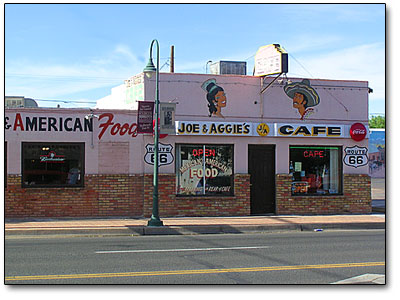
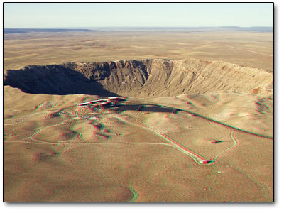
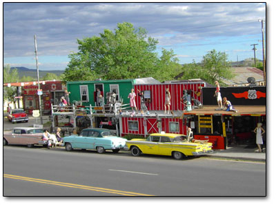
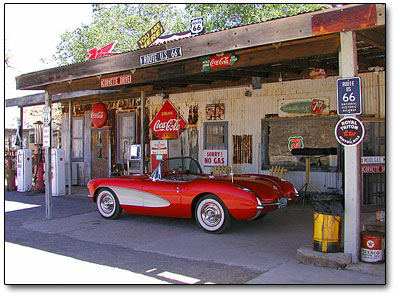
Flagstaff is a city located in northern Arizona and the county seat of Coconino County. The city is named after a Ponderosa Pine flagpole made by a scouting party from Boston known as the Second Boston Party to celebrate the United States Centennial on July 4th, 1876. Flagstaff is situated near the southwestern edge of the Colorado Plateau, along the western side of the largest contiguous ponderosa pine forest in the continental United States. Flagstaff is located adjacent to Mount Elden, just south of the San Francisco Peaks, the highest mountain range in the state of Arizona. Humphreys Peak, the highest point in Arizona, at 12,633 feet or 3,851 meters, is located about 10 miles or 16 kilometers north of Flagstaff in the Kachina Peaks Wilderness Area. Flagstaff is absolutely gorgeous and is a haven for residents of Phoenix who live in a hot desert climate. Many residents of Phoenix have cabins or second homes in Flagstaff where they can escape the extreme heat of the Valley of the Sun where Phoenix is located. It is home to Lowell Observatory, The U.S. Naval Observatory, the United States Geological Survey Flagstaff Station, and Northern Arizona University. Flagstaff has a strong tourism sector, due to its proximity to the Grand Canyon National Park, Oak Creek Canyon, the Arizona Snowbowl, Meteor Crater, and the historic Route 66.
Flagstaff has an active cultural scene. The city is home to the Flagstaff Symphony Orchestra, which plays concerts from September through April at Ardrey Auditorium on the NAU campus. The city also attracts folk and contemporary acoustic musicians, and offers several annual music festivals during the summer months, such as the Flagstaff Friends of Traditional Music Festival, the Flagstaff Music Festival, Festival in the Pines and Pickin’ in the Pines – a three-day bluegrass and acoustic music festival held at the Pine Mountain Amphitheater at Fort Tuthill Fairgrounds.

Popular bands play throughout the year at the Orpheum Theater and free concerts are held during the summer months at Heritage Square. Flagstaff has acquired a reputation as a magnet for outdoor enthusiasts, and the region’s varied terrain, high elevation, and amenable weather attract campers, backpackers, climbers, recreation and elite runners, and mountain bikers from throughout the southwestern United States.

Air travel is available through Flagstaff Pulliam Airport which is located just south of the city. The airport is primarily a small, general aviation airport with a single 6,999 feet or 2,133 meter runway. The airport finished a major expansion project to add 1,800 feet or 550 meters to the north end of the current runway and lengthen the taxiway in 2007. The primary purpose of the project was to increase its viability for commercial and regional jets. Service to connecting flights at Phoenix Sky Harbor International Airport is provided by US Airways Express operated by Mesa Airlines.

During the 1940s and 1950s, over 100 western movies were filmed in nearby Sedona and Oak Creek Canyon. The Hotel Monte Vista in Flagstaff hosted many film stars during this era, including Jane Russell, Gary Cooper, Spencer Tracy, John Wayne, and Bing Crosby. A scene from the movie Casablanca was filmed in one of the rooms of the hotel. In the early 20th century, the city was considered as a site for the film The Squaw Man by Jesse Lasky and Cecil B. DeMille, but was abandoned in favor of Hollywood. Several recent movies have been filmed, at least in part, in Flagstaff. A small scene in Midnight Run was filmed in Flagstaff at the train depot, the city was also referenced in the film. Several of the running scenes in Forrest Gump were filmed in and around the area, including a memorable scene where Forrest is seen jogging in downtown Flagstaff. Parts of 2007 Academy Award winner Little Miss Sunshine were filmed at the junction of I-40 and I-17 in Flagstaff, and Terminal Velocity was partially filmed in the city.

On to Seligman (Havasupai: Thavgyalyal), in Yavapai County, Arizona. Seligman was founded between 1889 to 1891 by the Theut and Moultrie families. Both were prosperous slaughterhouse owners from Southern antebellum families who lost everything in the Civil War and the Reconstruction periods. They moved West hoping to find a new life in the largely uninhabited territory of Arizona. They took over the area of Seligman Campsite from the Apache Indians. John Lasseter has said that the town of Radiator Springs in his film Cars is loosely based on Seligman.

While researching the history of Route 66, Lasseter met Seligman barber Angel Delgadillo, who told him how traffic through the town virtually disappeared on the very day that nearby Interstate 40 opened.

Delgadillo’s brother Juan opened Delgadillo’s Snow Cap Drive-In in 1953 and the eatery has since become a famous roadside attraction. Author, Route 66 historian and Cars voice actor Michael Wallis covers the history of the restaurant in his book, Route 66: The Mother Road.

Next is Kingman (Mojave: Huwaalyapay Nyava), a city in Mohave County, Arizona. The nearby communities of Butler and Golden Valley bring the Kingman area total population to over 66,000. Kingman is located 33 miles or 53 kilometers east of Bullhead City, Arizona, 85 miles or 137 kilometers southeast of Las Vegas, Nevada, about 165 miles or 266 kilometers northwest of Phoenix, Arizona and about 250 miles or 400 kilometers northeast of Los Angeles, California. Bullhead City lies just across the Colorado River from Laughlin, Nevada. Laughlin is 90 miles or 140 kilometers south of Las Vegas situated in the far southern tip of Nevada.

It is best known for its gaming, entertainment, and water sports recreation. It is basically a mini-Las Vegas with nine hotel/casinos providing over 10,000 rooms, 94,000 square feet of meeting space, 60 restaurants, two museums, a 34-lane bowling center and a variety of boutiques, spas and salons. More than 14,000 casino workers cross the Colorado River by shuttle boat or drive across the Laughlin Bridge each day. Laughlin casinos cater mainly to the retirees that it buses in from Phoenix every day. The original casino called the Colorado Belle was built by Don Laughlin who founded the town for just that purpose.

The films Roadhouse 66 and Two-Lane Blacktop were shot in Kingman. The movie Management takes place in Kingman. Scenes from the movie Fear and Loathing in Las Vegas were filmed at the Kingman Airport; in the scenes, it is possible to see a clear shot of the Hualapai Mountain. Scenes from the 1992 movie Universal Soldier were filmed in the downtown area as well as a local grocery store and at the Kingman Airport. The town is also mentioned in the lyrics to the Bobby Troup song – “Route 66”. Kingman is the closest city to the Grand Canyon Skywalk, a transparent horseshoe-shaped cantilever bridge and tourist attraction on the edge of the Grand Canyon.

One of the biggest claims to fame for Kingman, Arizona is the Kingman Explosion, also known as the Doxol Disaster. It was a catastrophic boiling liquid expanding vapor explosion that occurred on July 5th, 1973 in Kingman. The explosion occurred during a propane transfer from a Doxol railroad car to a storage tank on the rail siding near Andy Devine Avenue on Route 66. It began when a railroad worker attempted to tighten a leaking connection by hitting a wrench with another wrench and caused a spark that ignited the leaking propane gas.

The initial fire badly burned the two railroad employees present, one of whom later died from his burns. The burning propane gas escaping from the valve connection on the rail car quickly heated the liquid propane inside, increasing the tank pressure. This in turn increased the leak and fire, further heating the tank car. The Kingman Fire Department responded, and began setting up attack lines to cool the propane car. Within minutes of the initial fire, the safety valve on the car opened from the dangerously increased pressure in the tank car. The stream of propane gas blowing out of the safety valve immediately ignited as well.

At that point, two burning streams of propane were shooting out of the car, one horizontal from the transfer valve, and one vertical from the safety valve. The heat from the streams of burning propane continued to heat the tank, increasing pressure to dangerous levels. The fire department was in the process of setting up a deluge gun to cool the car, which would have delivered far more water than the booster attack lines they initially were using; however, before the deluge gun could be made ready, the pressure inside the tank car reached the design bursting limit and the tank car exploded. Almost instantaneously, thousands of gallons of boiling liquid propane flashed to gas with the drop in pressure and simultaneously ignited. The resulting explosion produced a shock wave that was heard and felt for over 5 miles with a fireball over 1,000 feet in diameter. Burning propane rained down on everything in the vicinity, and the remnants of the rail car were propelled over a quarter mile from the explosion site. The three firefighters closest to the explosion were killed instantly; eight more died from their burns shortly thereafter. In addition to the eleven city firefighters and one railroad worker killed in the disaster, over 90 onlookers gathered on the highway were burned or injured, some badly. The most severely burned, including some of the firefighters, were airlifted to hospitals in Las Vegas and Phoenix making this incident the worst firefighting disaster in Arizona history.

0 Shares