Into the Land of Enchantment, as the state of New Mexico is referred to. If you ever witness the special light of a New Mexico sunset coupled with the hue of the soil and the clear blue skies, you’ll understand why it has earned the nickname. In New Mexico the next town of import encountered is Tucumcari which is a city in and the county seat of Quay County, New Mexico. In 1901 the Rock Island and Pacific Railroad built a construction camp in the western portion of modern-day Quay County. Originally called Ragtown, the camp became known as Six Shooter Siding, due to its numerous gunfights.

Its first formal name, Douglas, was used only for a short time and after it grew into a permanent settlement, it was renamed Tucumcari in 1908. The name was taken from Tucumcari Mountain, which is situated near the community. Where the mountain got its name is uncertain, but it may have come from the Comanche word “tukamukaru”, which means to lie in wait for someone or something to approach. A 1777 burial record mentions a Comanche woman and her child captured in a battle at Cuchuncari, which is believed to be an early version of the name Tucumcari.

Legend has it that Apache Chief Wautonomah was near death and was troubled by the question of who would succeed him as ruler of the tribe. In a classic portrait of love and competition, his two finest braves, Tonopah and Tocom, Chief Wautonomah beckened Tonopah and Tocom to his side and announced, “Soon I must die and one of you must succeed me as chief. Tonight you must take your long knives and meet in combat to settle the matter between you. He who survives shall be the Chief and have my daughter Kari for his wife.” Not only were these two braves rivals and sworn enemies of one another, but were both vying for the hand of Kari, Chief Wantonomah’s daughter. Kari knew her heart belonged to Tocom and as ordered, the two braves met, with knives outstretched, in mortal combat. Unknown to either brave was that Kari was hiding nearby. When Tonopah’s knife found the heart of Tocom, the young squaw rushed from her hiding place and used a knife to take Tonopah’s life as well as her own. When Chief Wautonomah was shown this tragic scene, heartbreak overwhelmed him and he buried his daughter’s knife deep into his own heart, crying out in agony, “Tocom-Kari”! With a slight variation in spelling, the Chief’s dying words live on today as Tucumcari, and the mountain symbolizes the story. Some credit this folk tale to Geronimo. Others, believing the claims to be apocryphal, purport the tale variously to have been concocted by anyone from a 1907 Methodist minister to a group of local businessmen seated together at the old Elk Drugstore each embellishing their own rendition of the story.

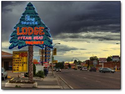
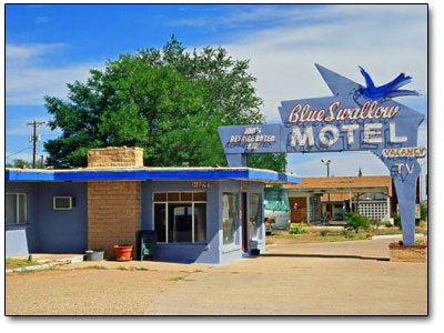
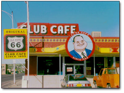
Tucumcari has been a popular stop for cross-country travelers on Interstate 40 (formerly U.S. Route 66 in the area). It is the largest city on the highway between Amarillo, Texas and Albuquerque, New Mexico. Route 66 runs through the heart of Tucumcari via Route 66 Boulevard, which was previously known as Tucumcari Boulevard from 1970 to 2003 and as Gaynell Avenue before that time. Numerous businesses, including gasoline service stations, restaurants and motels, were constructed to accommodate tourists as they traveled through on Route 66. A large number of the vintage motels and restaurants built in the 1930s, 1940s, and 1950s are still in business despite intense competition from newer chain motels and restaurants in the vicinity of Interstate 40, which passes through the city’s outskirts on the south.

From Tucumcari westward down Route 66 is the town of Santa Rosa, a city in and the county seat of Guadalupe County, New Mexico. It lies between Albuquerque and Tucumcari, situated on the Pecos River at the intersection of Interstate 40, U.S. Route 54, and U.S. Route 84. The city is located west of, but not within, the Llano Estacado or “staked plains” of eastern New Mexico and west Texas. Santa Rosa’s stretch of U.S. Route 66 is part of film history. When John Steinbeck’s epic novel, The Grapes of Wrath, was made into a movie, director John Ford used Santa Rosa for the memorable train scene.

Tom Joad, played by Henry Fonda, watches a freight train steam over the Pecos River railroad bridge, into the sunset. It was also one of shooting scenes for Bobbie Jo and the Outlaw starring Lynda Carter in the title role. Santa Rosa has many natural lakes, a seeming anomaly in the dry Desert climate surrounding it. These are sinkholes that form in the limestone bedrock of the area and fill with water, and thus the lakes are connected by a network of underground, water-filled tunnels. The most famous of these is Blue Hole, a popular spot for diving, where cool 61°F or 16°C water forms a lake over 81 feet or 25 meters deep.

In the Pre-1937 alignment of Route 66 the highway went northwards outside of Santa Rosa and went towards Santa Fe via the road to Romeroville. This route affords far better scenery than the route that continued westward past Clines Corner to Tijeras. The road between the highway turnoff to Romeroville and Romeroville itself is an axceptional road lined with old Mexican ranches with salt cedar branch fences and adobe ranch houses. The highway from Romeroville heads into the mountainous area of Glorieta and Canoncita. Glorieta is in Santa Fe County, New Mexico and was the site of two important battles in New Mexico history – the Battle of Santa Fe and the Battle of Glorieta Pass. In Canoncito is a historic church building 13 miles southeast of Santa Fe, north of the I-25 frontage road named the Nuestra Senora de Luz Church and Cemetery. It was built in 1880 and added to the National Register in 1995.

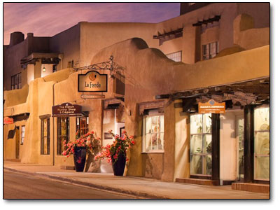
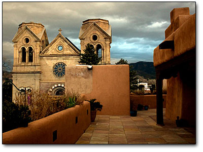
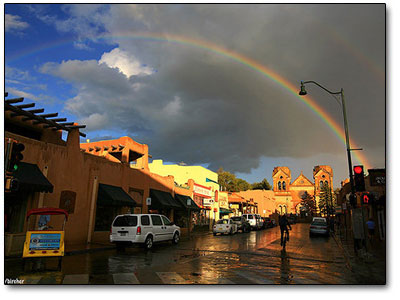
Now into Santa Fe, the capital of New Mexico. It is the fourth-largest city in the state and is the seat of Santa Fe County. The full name of the city when founded was La Villa Real de la Santa Fé de San Francisco de Asís – The Royal Town of the Holy Faith of St. Francis of Assisi. The city of Santa Fe was originally occupied by a number of Pueblo Indian villages that were settled between 1050 to 1150. One of the earliest known settlements in what today is downtown Santa Fe came sometime after the year 900.
A Native American group built a cluster of homes that centered around the site of where the Plaza sits today and spread for half a mile to the south and west – the village was called Ogapoge. Santa Fe is at least the third oldest surviving American city in the 50 states that was founded by European colonists, behind the oldest St. Augustine, Florida settled in 1565. A few settlements were founded prior to St. Augustine but all failed, including the original Pensacola colony in West Florida, founded by Tristán de Luna y Arellano in 1559, with the area abandoned in 1561 due to hurricanes, famine and warring tribes. Fort Caroline, founded by the French in 1564 in what is today known as Jacksonville, Florida only lasted a year before being obliterated by the Spanish in 1565. In 1912, when the town had only 5,000 residents, the city civic leaders designed and enacted a complex city plan that incorporated elements of the City Beautiful movement, the city planning movement, and the German historic preservation movement. It anticipated limited future growth, considered the scarcity of water, and recognized the future prospects of suburban development on the outskirts. The planners foresaw conflicts between preservationists and scientific planners. They set forth the principle that historic streets and structures be preserved and that new development must be harmonious with the city’s character.
Artists and writers, as well as older retired visitors were attracted to the cultural richness of the area, the beauty of the landscapes and its dry climate. Local leaders began promoting the city as a tourist attraction. The city sponsored architectural restoration projects and erected new buildings according to traditional techniques and styles, thus creating what is termed “Santa Fe style”. Edgar L. Hewett, founder and first director of the School of American Research and the Museum of New Mexico in Santa Fe, was a leading promoter. He began the Santa Fe Fiesta in 1919 and the Southwest Indian Fair in 1922
now known as the Indian Market. When he tried to attract a summer program for Texas women, many artists rebelled saying the city should not promote artificial tourism at the expense of its artistic culture. The writers and artists formed the Old Santa Fe Association and were able to defeat the plan. During World War II Santa Fe was the location of a Japanese American internment camp. Beginning in June of 1942, the Department of Justice held 826 Japanese-American men in a Civilian Conservation Corps facility which had been acquired for the purpose. By September, the internees had been transferred to other facilities and the camp was used to hold German and Italian civilian prisoners. In February of 1943 the civilian detainees were transferred back to Department of Justice custody and the camp was expanded to hold 2,100 men. In 1945 four internees were seriously injured when violence broke out between the internees and guards in an event known as the Santa Fe Riot. At the end of the war, the facility was closed and sold as surplus in 1946. This camp was located in what is now the Casa Solana neighborhood of Santa Fe.

In August of 1934 Georgia O’Keefe, the renowned American artist visited Ghost Ranch, north of Abiquiu near Santa Fe, for the first time and decided immediately to live there. But it was not until 194o that she purchased a house on the Ghost Ranch property. The varicolored cliffs of Ghost Ranch inspired some of her most famous landscapes.

In 1977, O’Keeffe wrote: “the cliffs over there are almost painted for you, you think — until you try to paint them.”

Among guests to visit her at the ranch over the years were Charles and Anne Lindbergh, singer-songwriter Joni Mitchell, poet Allen Ginsberg, and photographer Ansel Adams. Of the numerous museums dedicated to the arts in Santa Fe, the Georgia O’Keeffe Museum – devoted to the work of O’Keeffe and others whom she influenced, is one of the more popular. Most tourist activity in Santa Fe take place in the historic downtown, especially on and around the Plaza, a one-block square adjacent to the Palace of the Governors, the original seat of New Mexico’s territorial government since the time of Spanish colonization. Other areas include “Museum Hill”, the site of the major art museums of the city as well as the Santa Fe International Folk Art Market, which takes place each year during the second full weekend of July. The Canyon Road arts area with its galleries is also a major attraction for locals and visitors alike.
Gallup (Navajo: Naʼnízhoozhí) is a city in McKinley County, New Mexico. It is the county seat of McKinley County and the most populous city between Flagstaff, Arizona and Albuquerque, New Mexico. Gallup is known as the Heart of Indian Country because it lies in the middle of many Native American reservations and is home to many tribes. Route 66 runs through Gallup, and the town name is mentioned in the lyrics to the song, Route 66. The historic El Rancho Hotel & Motel has had numerous movie stars
including John Wayne, Ronald Reagan, Humphrey Bogart, Spencer Tracy, Katharine Hepburn, Joan Crawford, Kirk Douglas, Doris Day, Gregory Peck and Burt Lancaster as guests. The rugged terrain surrounding Gallup was popular with Hollywood filmmakers during the 1940s and 1950s for the on-location shooting of Westerns, and the actors and film crews would stay at the hotel during filming. Films made in Gallup included Billy the Kid in 1930, Pursued in 1947, The Sea of Grass in 1947, Four Faces West in 1948, Only the Valiant in 1951, Ace in the Hole in 1951, Escape from Fort Bravo in 1953, A Distant Trumpet in 1964 and The Hallelujah Trail in 1965. The presence of Navajo, Zuni, Hopi and other tribes make up one-third of the city’s population. The city is criticized in the novel Ceremony, authored by Native American writer Leslie Marmon Silko, for the city’s slums. Many drunken natives can be seen on the streets of Gallup and for the most part the city is not what you would deem a friendly place for strangers. Gallup is the last town of any import on the way westward into Arizona.
0 Shares